Visit Alberni Valley Explorer Guide Now!
Experience the Magic of Waterfalls in the Alberni Valley
Waterfalls are some of the most magnificent natural wonders of the world, and we’re lucky enough to be home to some beautiful waterfalls in the Alberni Valley. Seeking out waterfalls can be a daunting task, oftentimes requiring trekking up a mountain for the best views; we’re going to give you a breakdown of our top seven waterfalls in the Alberni Valley, ranging from easiest to hardest.
First on our list is the beautiful Stamp Falls Provincial Park. Located 14km down Beaver Creek Road, Stamp Falls is a short 1.3km hike with 49m elevation gain, making it perfect for the entire family. Stamp Falls offers spectacular views all year round; in late summer and early fall you can watch the salmon make their way upstream, winter and spring bring raging rapids that will make you appreciate the strength of water, and summer offers calmer waters with little wading pools to cool off. This trail offers multiple viewpoints along the river and falls, and will be sure to awe the entire family. Dogs are allowed but must be kept on leash. Remember to be bear aware, especially during the fall salmon season.
Next on our list is the beautiful and lush Fossli Provincial Park. Travelling towards Sproat Lake, make a left onto McCoy Lake Road, left onto Stirling Arm Drive, left onto Ash Main, and right onto Stirling Arm Road, after about 4km the trailhead will be on your right hand side. Park as far over as possible to allow others access. Access to this trail does require driving on logging roads, so please be aware and always give logging trucks the right of way. Once you’ve parked, follow the road down the hill, staying left until you reach the trailhead. Fossli Park is a 3.4km easy trail with 93m elevation gain. The waterfall is downstream from the suspension bridge across the creek. The waterfall travels down the rocky and moss covered creek, with a magnitude of ferns and trees on either side. Fossli Park is truly a magical place to explore with beautiful views of Sproat Lake, birch and old growth trees, ferns, and a lush layer of moss covering almost every surface. Perfect for kids and dogs, this is the perfect hike for the entire family.
Let’s head further down Sproat Lake to Weiner Falls, located across Hwy 4 from the Sproat Lake Landing Resort, stay right after you turn off the highway and head up a short hill, turn left down a logging road, park just before the bridge off the road and start walking along the road to the right just before the bridge. This trail is an easy/moderate 3.9km hike with 145m elevation gain. As you head up the hill along the road, you’ll be met with a fork where you can stay on the logging road or travel along the trail. After about 1km the trail will veer left, down towards the lower falls, offering swimming at the very bottom of the falls and a beautiful view from the top. You can either stop there (highly suggested if you have small children), or head back up the trail towards the upper falls. There is a section of trail that travels along a steep cliff with a rope along the mountain wall, but the views are well worth it. Carry on until you reach the upper falls and enjoy the waterfall and views for a while, before heading back the way you came. The lower falls is great for kids of all ages, but the upper falls is better reserved for older kids. Dogs are allowed, but please keep them on leash.
Plan Your Adventure
Get ready for your adventure in Alberni Valley Explorer Guide. Our guide offers everything you need to know about the city's top attractions, events, and activities. From the best restaurants to the most scenic hiking trails, we've got you covered. Plan your itinerary and make the most of your time in Alberni Valley Explorer Guide.
popular waterfalls in the alberni valley

Weiner Falls
Weiner Falls
Weiner Falls
From the top of the falls: this is the easier and more leisurely option to take in the grand views of this powerful waterfall. Follow the road about 15 minutes, taking in the fresh air into your lungs and noticing the serine surroundings. You will reach the top of the falls, which boasts amazing photo opportunities – bring your camera!
Stamp Falls
Weiner Falls
Weiner Falls
Stamp River Provincial Park is a quick 15 minute drive down Beaver Creek Road; perfect for camping, day hikes through breathtaking forest and waterfall views, or relaxation by the river, Stamp River has it all. One of the main attractions of the park is it’s annual run of thousands of Pacific salmon swimming in the pool below the falls,
Stamp River Provincial Park is a quick 15 minute drive down Beaver Creek Road; perfect for camping, day hikes through breathtaking forest and waterfall views, or relaxation by the river, Stamp River has it all. One of the main attractions of the park is it’s annual run of thousands of Pacific salmon swimming in the pool below the falls, before ascending up the ladder to the spawning grounds; this natural migration happens during late summer and early fall months.
Della Falls
Weiner Falls
Della Falls
Della Falls is located at the west end of Great Central Lake in Strathcona Provincial Park, about 25 minutes from Port Alberni. At 440 metres (1456 feet), Della Falls is the highest waterfall in Canada and one of the highest falls in North America.
photo credit adam copp
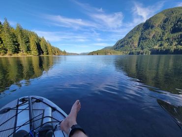
Sproat Lake Voted the Best Lake in B.C.
Sproat Lake is one of the best places to spend these hot summer days, and we know this, because people come from all over the world to experience our beautiful lake.
If this is your first summer on Vancouver Island or the Alberni Valley, it can feel daunting checking out the new swimming hole; especially if you’ve moved from Vancouver or elsewhere on the mainland. You may be conditioned to get to the lake as early as possible to scope out a parking spot and ideal spot on the beach; you know the ones with just the right amount of sun and shade throughout the day. Pulling up to Sproat Lake Provincial Park may leave you feeling disheartened, with cars and trucks lined up along the road leading down to the lake, but once you make it past the boat launch, you will be pleasantly surprised to see ample parking.
With over 90km of shoreline, there is always somewhere to set up for your visit to the lake, even in 40 degree weather. Whether you’re at Sproat Lake Provincial, Taylor Arm, hiking in through Fossli Provincial Park, jumping off Dickson Dock, or you’re lucky enough to live or know someone who lives on the lake, there’s guaranteed to be a spot for you to cool down.
With a relatively rocky surface, there isn’t the mess that accompanies sandy beaches, but it definitely pays off to have a good pair of sandals or water shoes to protect your feet. The water typically stays cool until at least August, before warming up nicely, but with our most recent heatwave, the lake is sure to warm up nicely, while still offering an opportunity to cool off in this heat.
The original name given to the lake was Kleh-Koot or “wide open”, and the eastern most arm of the lake is still referred to as Kleh-Koot; once settlers arrived the lake was renamed in 1913 by Robert Brown, who named the lake in honour of Gilbert Sproat. Sproat arrived in the Valley in 1860 from Scotland, he was an honoured colonial officer and entrepreneur, he helped found one of Port Alberni’s first sawmills. When the sawmill burnt down in 1865 he moved back to England, but continued to play an active role in the colony, finally moving back to the province in 1876.
In 1855 a road was constructed from Port Alberni to Sproat Lake, and since then it has been a highly sought after residence. After the building of Klitsa Lodge in 1910, which originally started as a summer home for prominent lawyer E.P Davis, Sproat Lake began attracting people from across the world. In 1915 a houseboat was built for Mrs.Wark who used it to serve tea and lunch. In 1919 she purchased Klitsa Lodge from E.P Davis, which became a popular summer destination and over the years many of the rich and famous visited this spot. In 1920, a millionaire from New York, Cornelius Vanderbilt Jr., and his wife were travelling past Sproat Lake on their way to California when Mrs. Vanderbilt spotted Arbutus Island and fell in love; Mr. Vanderbilt then purchased the island for his wife and lodge was built for the couple and their wealthy friends to visit during the summer, aptly named Vanderbilt Lodge. Locals began calling the island Vanderbilt Island, and it is still referred to as that to this day.
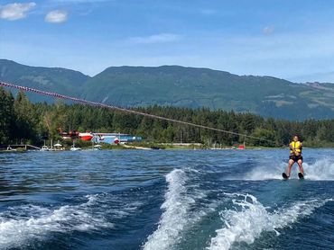
Sproat Lake has been home to water bombers, specifically, the Martin Mars Bomber. The Martin Mars was originally built by the Martin Company for the United States Navy, and was used in World War II as a long range ocean patrol flying boat. Only seven were built, and four surviving aircrafts were later converted into firefighting water bombers which were purchased by Forest Industries Flying Tankers (FIFT) in 1959. The aircrafts were flown to Fairey Aviation at Victoria and converted into water bombers. Only two tankers have survived, and are stationed on Sproat Lake. These bombers offer a sense of community pride to both Sproat Lake and Port Alberni residences.
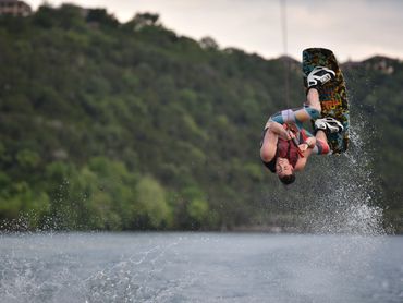
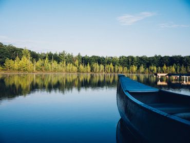
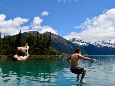
Sproat Lake’s history is rich and fascinating. From the First Nations people who have lived off the land for thousands of years, to the European settlers, Sproat Lake has a long and intercrite story to tell. With it’s magnificent mountain ranges, and seemingly endless blue waters, surrounded by old and new growth forests. Sproat Lake truly is one of the best places to visit this summer.Swimming isn’t the only thing worth doing at Sproat Lake; the lake is big enough to accommodate houseboats, speed boats, kayaks, canoes, paddleboards, and epic floaties. Bring your own or rent from local businesses at the lake and in the Alberni Valley. If you are exploring the lake in a boat, please ensure that you are looking out for those waterbound folks and keeping a safe distance from the shore.
Sproat Lake truly is the best place to spend your summer, anytime of day. It’s fantastic to cool off in the evenings, spend hours playing and swimming, or for some early morning exercise, Sproat Lake is sure to be the best place you’ll be this summer.

Sights and Scenes of Alberni Valley Explorer : A Captivating Photo Gallery of Our Beautiful sproat lake